

The central part of Northfield parish around the church, as drawn in 1714. Northfield is now a heavily urbanised suburb of Birmingham, six miles south of the centre, but at this time was a village surrounded by farmland. The area around the church is still a reminder of Northfield's Georgian, and even more distant part; with a Norman arch set into the wall of the church, this site has hundreds of years of history. So, what still remains from the time of the map?
 |
| The Village Pound, Northfield, 1953. Phyllis Nicklin. |
The pound, which can be seen on the centre-left of the map, was used to tether animals that had escaped their owners, who would have to pay a small fee to have them returned.
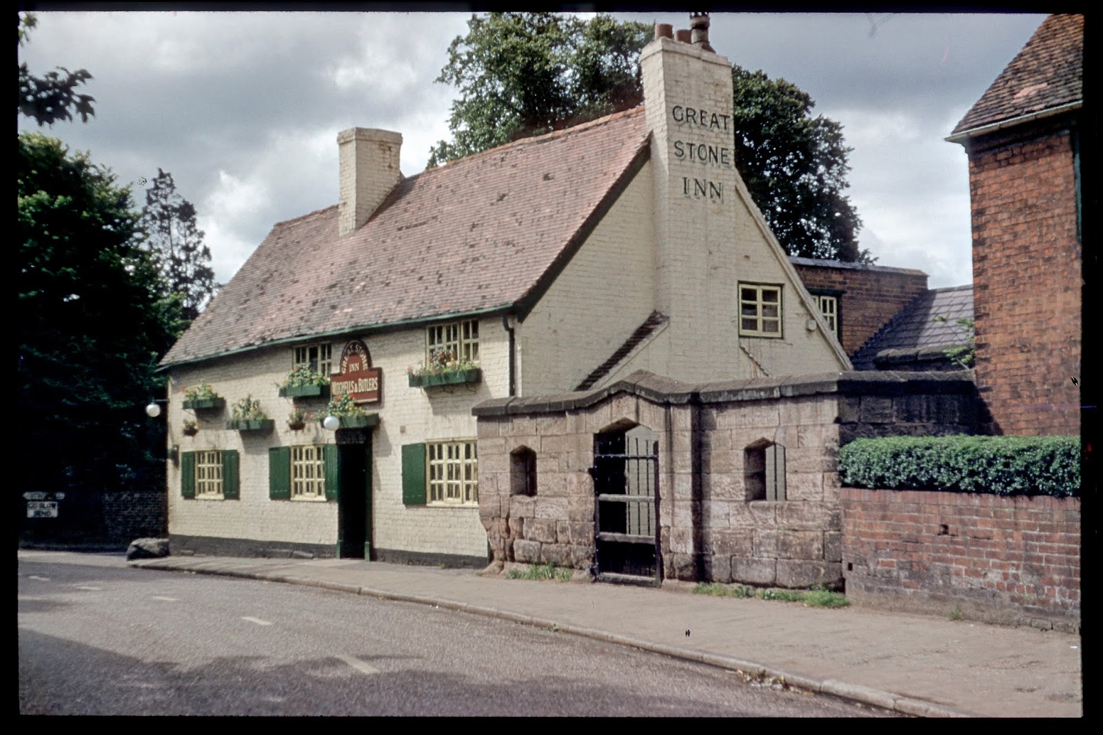 |
| The Great Stone Inn, next to the pound, 1953. Phyllis Nicklin. |
The Great Stone public house can seen just beneath the village pound on the map, but in reality the two are joined. The name derives from the 'great stone' that was situated at the corner of the pub, which has now been moved (the reason being pretty self explanatory from the image below) and placed inside the Village Pound for safe keeping.
 |
| The 'great stone' outside the Great Stone |
At the top of the map, the road leading off to the right states that it leads 'to Middleton Hall'. This road remains as Middleton Hall Road, the remnant of a long demolished smart dwelling house.
 |
| The scene including the church by Arthur Lockwood, 1958. |
The parish church can be seen at the bottom of the map, with a path cutting across to the vicarage. The scene that Arthur Lockwood depicted in 1958 is the same as today's, except devoid of cars.